


©2023 Savvy360, LLC. All Rights Reserved
PLAN A TRIP IN OUR APP
Take A Hike
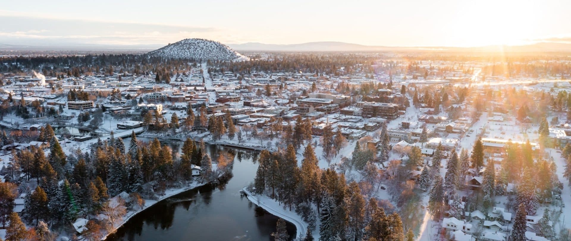
Pilot Butte is one of Bend’s best hiking spots perfectly situated right in the middle of town.
BY Meghan Robins
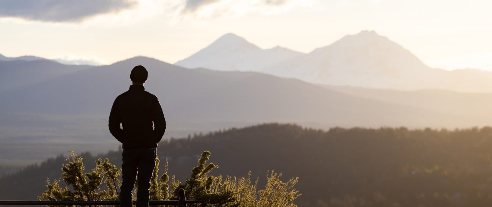
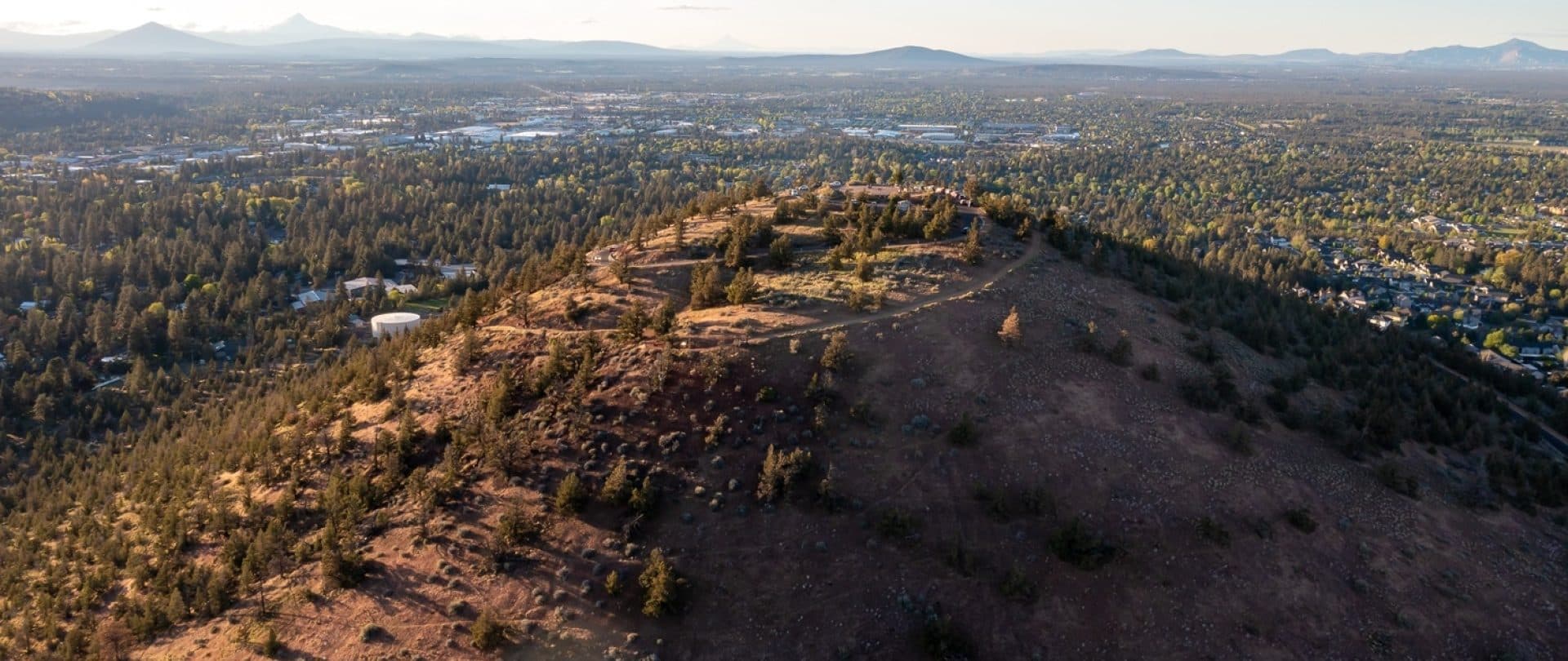
For a panoramic view of Bend, the Cascades, and, on a clear day, at least a dozen different mountains, take a hike up Pilot Butte. Located just off Highway 20/NE Greenwood Ave., this spot offers stunning views right from the heart of the town. A climb of just 500 feet, bringing you to a height of approximately 4,140 feet above sea level, takes you to the summit of Pilot Butte. From this vantage point, you can see a stunning array of mountains to the west, including (from south to north) Mt. Bachelor, Broken Top, South Sister, Middle Sister, North Sister, Mt. Washington, Three Fingered Jack, Black Butte, Mt. Jefferson, and, on a clear day, Mt. Hood. If the day is particularly crisp, you might even spot Mt. Adams farther to the north, with Smith Rock’s jagged orange formations visible in the foreground. To the east of Pilot Butte, on the outskirts of town, lies the Oregon Badlands Wilderness Area, a striking desert landscape, along with Horse Ridge, which is another excellent destination for winter hiking and mountain biking.
If you turn to the south, you'll see Paulina Peak, which is the remnant of Newberry Volcano. This volcano erupted nearly 600,000 years ago and used to stand 9,000 feet above sea level, with a base stretching 25 miles. It was named after the naturalist Dr. John Strong Newberry, who was part of the U.S. Army Pacific Railroad Survey crew in the late 1850s. When Newberry Volcano erupted, it released a series of lava flows that spread across Central Oregon, covering the landscape as far north as the Crooked River and Smith Rock and as far east as Prineville.
About 188,000 years ago, Pilot Butte was formed when underground magma pushed up a section of the earth, creating a vent. From this vent, fragments of lava erupted into the sky, solidified, and then fell back down as tiny cinder particles, accumulating into a dome that resembles an ant hill. When you stand atop Pilot Butte and look south toward Paulina Peak, you’ll see nearly 400 other cinder cones scattered across the landscape, all created over time in the same manner. Standing as a unique rise in an otherwise flat landscape, Pilot Butte has long been a valuable landmark to the Indigenous Peoples of Central Oregon, who have used it as a viewpoint to track herds, invaders and weather patterns. Archeologists have recorded findings proving humans have lived in Central Oregon since at least 13,000 years ago. Today, Wasco, Warm Springs and Paiute Nation members comprise the Confederated Tribe of Warm Springs and explain that their people have lived here since time immemorial.
In the 1830s, early colonizers began arriving and found the viewpoint helpful in navigating trails and gaining their bearings. According to the Oregon State Parks website, “The land was given to the state in 1927 in memory of Terrence Hardington Foley by his Bend business associates. Additional tracts were purchased in 1941.” If you’re getting turned around today by all of Bend’s roundabouts, use Pilot Butte as a time-tested way of reorienting yourself.
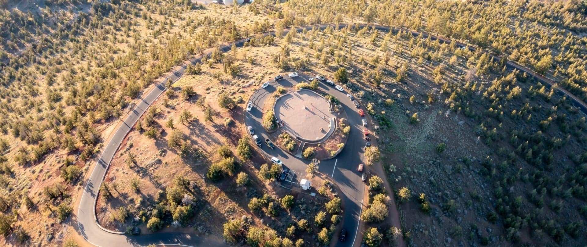
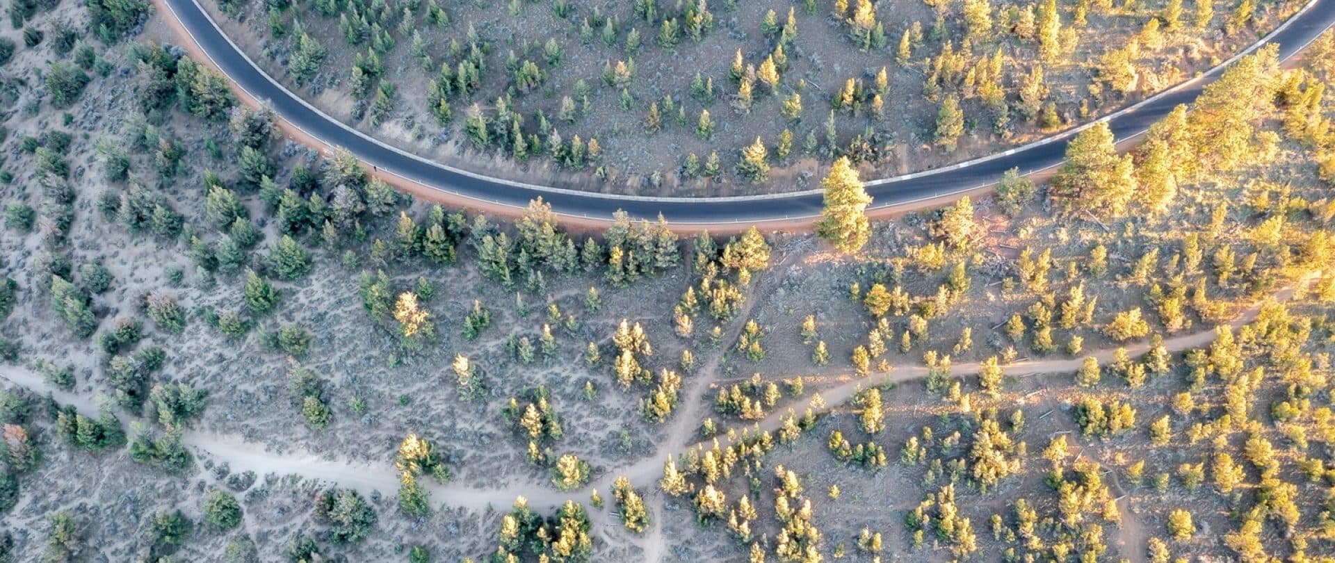
In the summer, the paved road to the summit is open to cars, cyclists, runners and strollers. During winter, the green gate closes, and Pilot Butte becomes a car-less sanctuary. Two trails wind up in a counterclockwise direction: The paved road with a dirt walking path beside it called the Summit Road Trail and the Pilot Butte Nature Trail, which is about a one-mile hike from the parking lot to the summit. A third trail, called the Base Trail, is a one-and-a-half-mile loop that, you guessed it, circumnutates the base of Pilot Butte.
As an official Oregon State Park, Pilot Butte State Scenic Viewpoint is one of the most visited recreation areas within Bend’s city limits by residents and visitors. Cyclists, hikers and runners are often seen clocking laps up and down. There are morning meet-up groups, community nonprofits like the Pilot Butte Summit Seekers and others who encourage people to track their annual improvements for how well, in what style and how many times you can summit the Butte in a year. Pilot Butte is wonderfully accessible thanks to the paved road (which gets quite steep in places, so be warned.)
Such heavy use does not come without consequences, however. Because Pilot Butte has become a staple for quick, accessible, view-worthy recreation, the crumbling cinder cone has seen degradation in the past decades. This has inspired community advocacy groups and landowner Oregon State Parks to implement various landscape maintenance tactics. Like all high desert landscapes, the Butte is subject to quick, difficult-to-repair erosion. A Fourth-of-July Bend tradition is for the city’s fireworks show to be launched off Pilot Butte’s paved summit, with the fire department dispersing around the summit’s edges to put out spotfires as they inevitably start. A few years ago, some illegal fireworks at the base caused a brush fire on the north side, the scars of which are still seen today. Recreationalists who choose to hike or bike off-trail leave footprints, little landslides, zig-zagging deer paths and bike ruts that are not easily repaired. The park strongly recommends that you always stay on the trail and help preserve this beautiful natural asset for everyone to enjoy.
Park employees are trying to preserve nature’s balance by performing seasonal landscape maintenance such as cutting down damaged or invading Western juniper trees. These trees are super water-thirsty and have increased in number due to fire suppression and past grazing. Because one juniper can drink up to 25 gallons of water per day, thinning them helps the surrounding plants like sagebrush, rabbit brush, wildflowers and ponderosa pines, all critical for a diverse habitat and preventing erosion.
Two different access points will get you to the top of Pilot Butte. In summer, when the green gates are open, the Summit Drive Road is accessible to drivers heading east or west on Highway 20/NE Greenwood Ave. In winter, when the Summit Drive is closed, and all year round, the only place to park is at the Pilot Butte Trailhead parking lot, which is only accessible when driving westbound on Highway 20/NE Greenwood Ave. Signage will lead you through a neighborhood into the parking lot, with a beautiful playground, bathrooms, picnic tables and a grassy field to enjoy.