


©2023 Savvy360, LLC. All Rights Reserved
PLAN A TRIP IN OUR APP

Scenic Treks
From accessible waterfalls to remote rainforests, Kaua‘i has no shortage of picturesque places to hit the trail.
BY Krystal Kakimoto
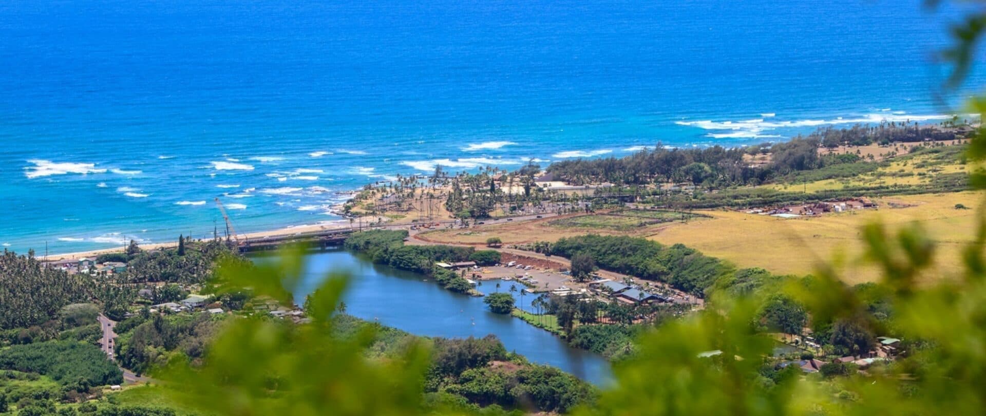
The beautiful valleys and verdant mountainsides of Kaua‘i are the perfect setting for exploring trails and understanding why the island is called the Garden Isle. Regardless of your age or hiking ability, the island offers a range of hikes with stunning views of its lush, tropical scenery. So put on your hiking shoes and take the time to explore some of the most popular trails on the island.
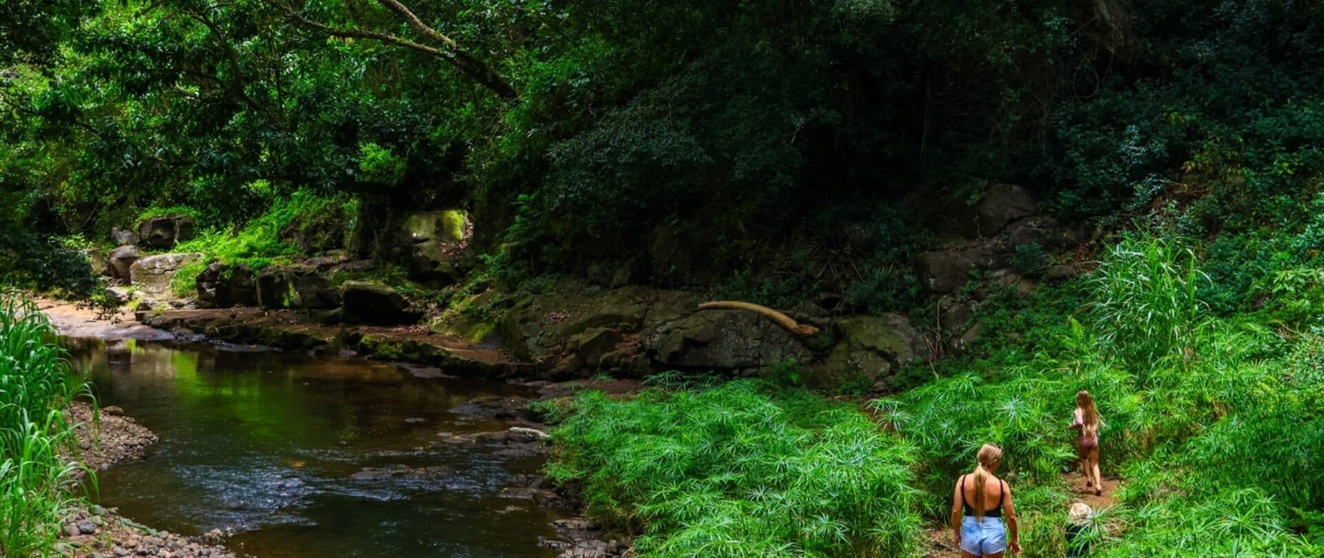
Ho‘opi‘i Falls Trail (Keiki friendly)
This 2-mile, out-and-back hike is nestled in the back of a residential area, taking hikers along a short, action-packed route to view two separate waterfalls and a variety of island flora. To reach the trailhead, head north along Kūhiō Highway through the town of Kapa‘a. Around the 9-mile marker, turn left onto Kawaihau Road and follow the road as it winds towards the mountains. After driving for about ten minutes, you will see Kapahi Road approaching on your right-hand side. Turn onto Kapahi Road and drive through the quiet, residential area for about 0.3 miles until a tiny break in the vegetation appears on the left-hand side of the street. In the same location, you will also see an equally tiny area where you can park your car parallel to the road.
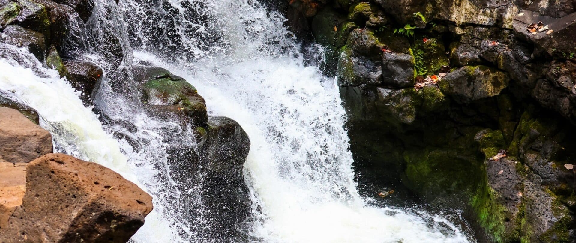
Enter this tiny break in the trees, and you will find yourself along the Ho‘opi‘i Falls Trail. The first part of the trail will take you directly into the jungle and along a dirt path under a canopy of towering trees. The path can be a little muddy, and many tree roots run below, so be sure to watch where you step to avoid falling or twisting your ankle. After about ten minutes of walking, the trail will start to run parallel to the Kapa‘a Stream, and you might start to hear the rush of the first waterfall as you approach. After about twenty minutes of walking, the first waterfall will appear, which measures about 30 feet in height. After cascading alongside a rock wall, the waterfall settles in a small pond below. While some enjoy dipping their feet in the pond, jumping into this pond is not recommended since there are rocks and shallow parts below that can cause injury. As you continue along the path, the second waterfall will shortly appear. Measuring about 15 feet in height, the upper waterfall empties into a larger pond below, where you might find some hikers swimming. Overall, the hike is flat, gaining only about 150 feet in elevation along its course, but there are a few parts that require you to scramble over rocks, which can be a strenuous maneuver. While the trail can be slippery, especially after it rains, this short hike can provide a few hours of joy without much exertion.
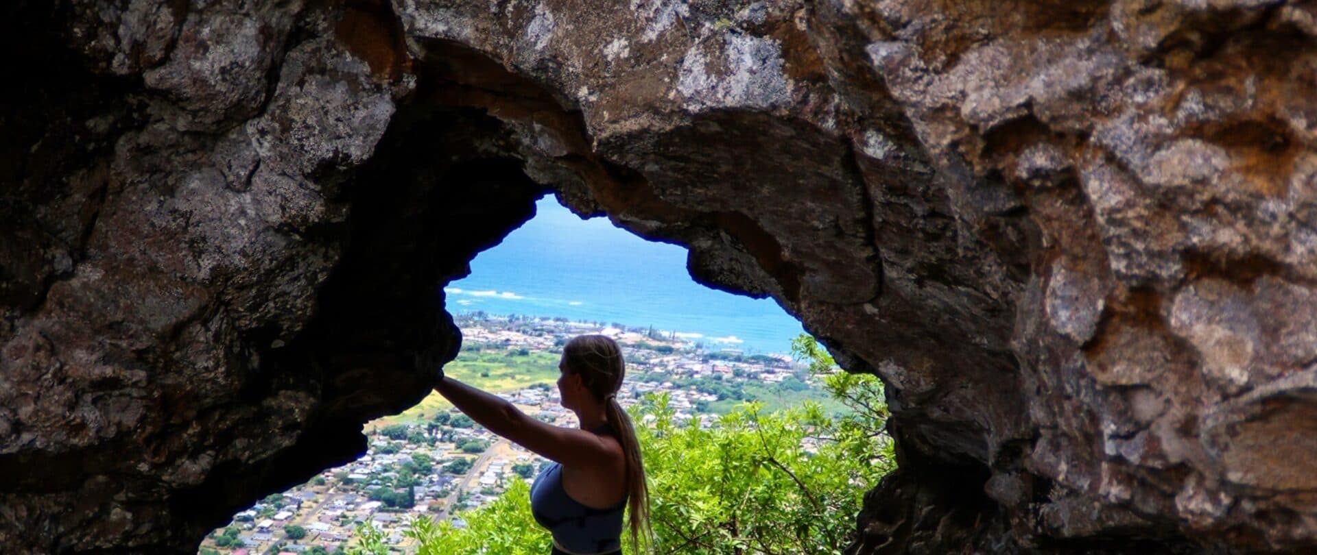
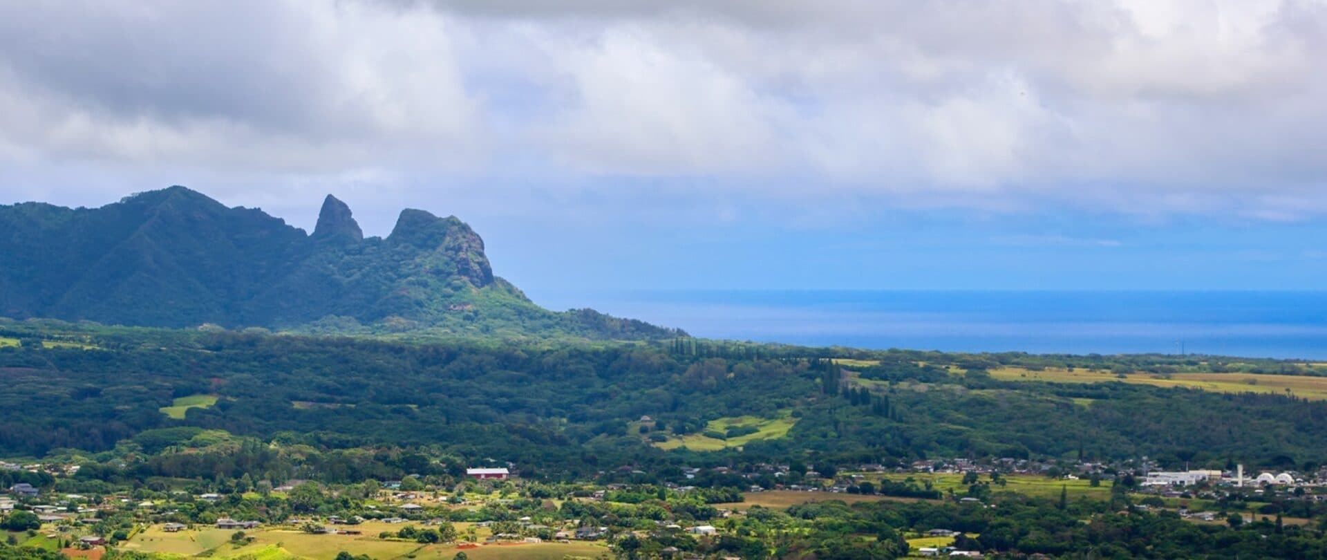
Sleeping Giant Trail (Moderate)
A little farther south, in the town of Wailua, you will find the Sleeping Giant Trail, one of the most heavily traversed trails on the island. Tucked in the back of the Wailua Houselots subdivision, this 3-mile, out-and-back hike snakes up the side of the mountain, rewarding hikers with panoramic views of Kapaʻa town, the Royal Coconut Coast and the Wailua River. Legend has it that long ago, the local villagers tricked a giant into eating many rocks they had hidden in fish and poi (steamed and mashed taro root). After overindulging, the giant laid down for a nap and has never awakened.
To reach the trailhead, turn towards the mountain from Kūhiō Highway into the Wailua Houselots subdivision and follow Haleʻīlio Road until you reach the base of the mountain. As the road starts to bend, you will come upon a gravel parking lot and a sign marking the Sleeping Giant Trail on the right-hand side of the road. After securing your vehicle, head to the right-hand side of the parking lot, where you will see a dirt path that cuts between the trees, leading you to the start of the eastern side of the trail. The first part of the trail will take you along a dirt path under the cover of dense foliage. At about 0.5 miles in, there is a bit of a scramble where you need to boost yourself over a formation of rocks, but this tends to be the most difficult part of the path. Continue along the route as it steadily increases in elevation until about the 2.5-mile mark, where the eastern trail merges with the western trail. From here, the two trails will straighten into one path, leading you under the cover of ironwood, guava, and silk oak trees. You will find benches and a picnic table under a small shack at the summit of Nounou Forest Reserve. With a total elevation gain of 1,000 feet, you will be at a vantage point to take in the stunning views of the surrounding area.
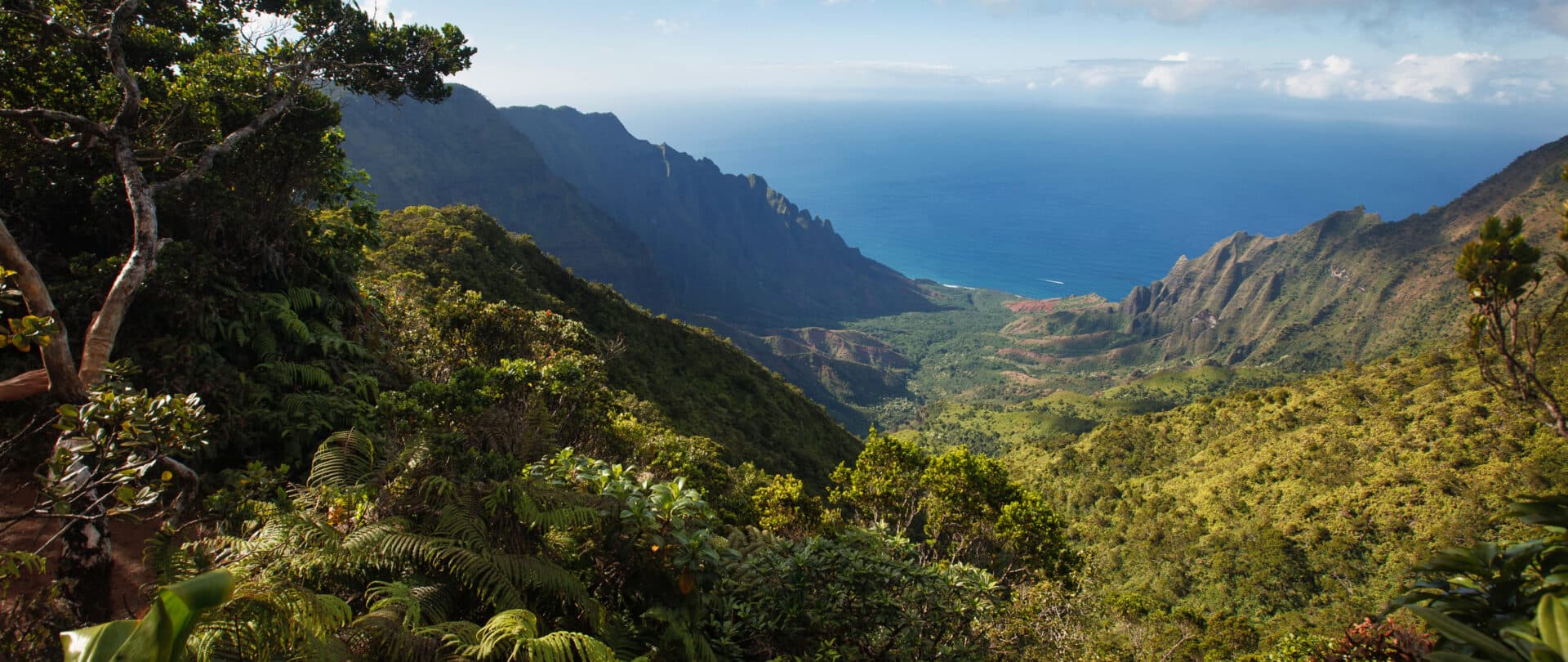
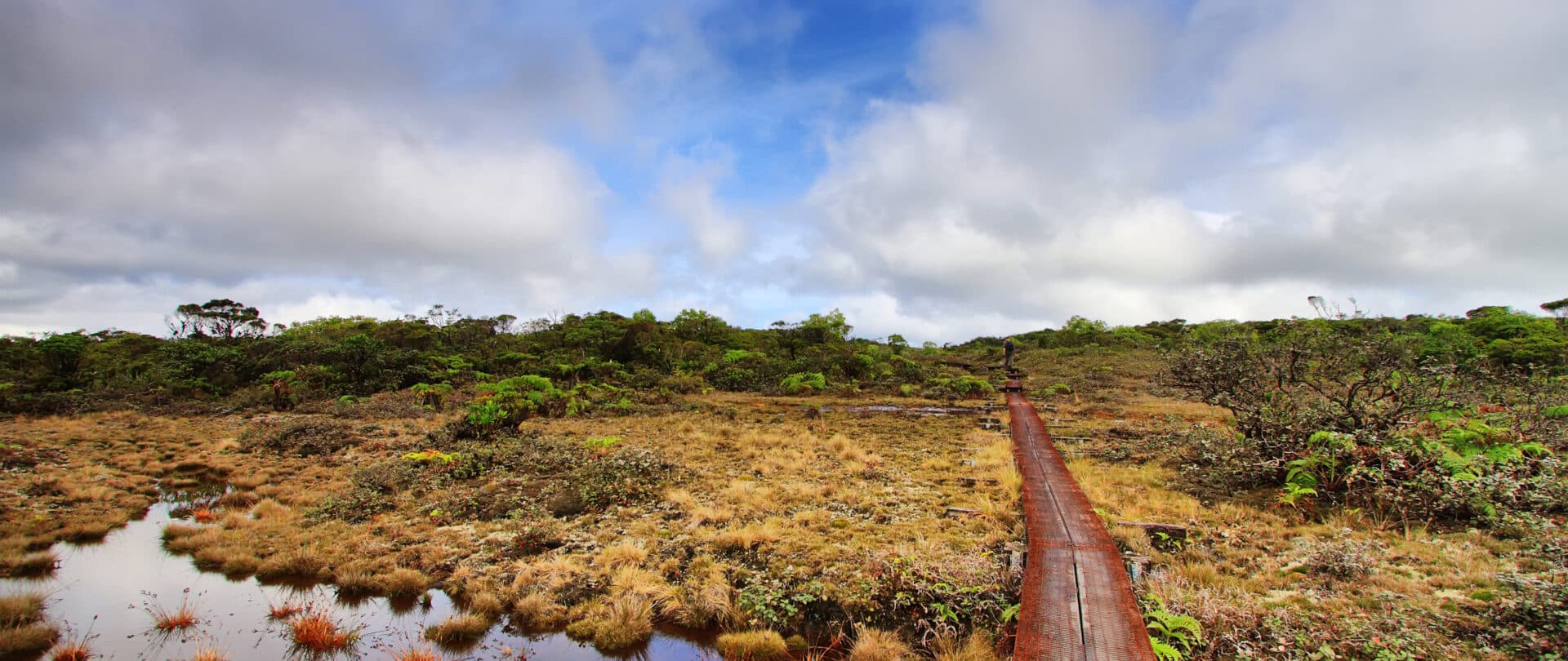
Alaka‘i Swamp Trail (Challenging)
Head to the pristine wilderness of Kokeʻe for a chance to hike the Alakaʻi Swamp Trail, one of the most unique trails in the entire state. This 8-mile, out-and-back trail takes hikers through bogs and the habitats of endemic plants such as ‘ōhi‘a lehua and hāpu‘u ‘i‘i (Hawaiian tree fern). It is an unforgettable experience that leads to the breathtaking Kilohana Lookout.
Gaining access to the trailhead of this hike can be difficult because it requires an additional hike to reach it. To start, drive along Kokeʻe Road, passing landmarks such as the Kokeʻe Natural History Museum and Kalalau Lookout. At the end of Kokeʻe Road, you will find a parking lot at the Puʻu o Kila Lookout. After securing your vehicle, hop onto the Pihea Trail, which winds through the forest leading to a fork in the path, which is the trailhead for the Alaka‘i Swamp Trail. After veering left onto the trail, you will find yourself walking along a dilapidated boardwalk that sits above the bog. Be careful to stay on the boardwalk to avoid sinking into the mud below and damaging any of the plants in the area. Despite being a well-known hike, the path is not as populated as other hikes on the island, and you may go for long distances before seeing another hiker or birdwatcher. After traveling through the fog, mist and dense native forest, you will come to the end of the trail and the Kilohana Lookout, which presents those who complete the route with rare views of Wainiha Valley and Hanalei Bay from perspectives that few can achieve. Although the entire route of the Pihea - Alaka‘i trails only sees an elevation gain of approximately 329 feet, it is important to remember that Kokeʻe is situated between 3,200 and 4,200 feet above sea level and that this elevation can put extra strain on the body.
No matter your ability level, hikes throughout the island will allow you to see the beauty of Kaua‘i up close. Whether you are venturing into a rainforest to view waterfalls or climbing new heights to reach some of the wettest parts of the earth, the varied hikes of Kaua‘i will provide you with multiple paths leading to new memories.